The weather is keeping us busy this winter. With the second major storm of 2014 comes WCAI's second live storm blog.
Here's how the storm is already affecting our region, what forecasters are predicting, and more storm-related information. Check back for regular updates, and share your photos.
January 22, 2014 - 12:45pm WCAI's Brian Morris got a first-hand look at tough travel conditions this morning on the Upper Cape. What are the roads like where you are?
January 22, 2014 - 11:00am The Weather Channel's new practice of naming winter storms has a lot of people crying media hype. WCAI's Heather Goldstone asked a handful of experts what they think of bombastic-sounding weather coverage. Perhaps surprisingly, most said that while social media allows information and new terms to spread faster, what's happening now isn't fundamentally different than in the past. What's your take?
January 22, 2014 - 10:15am WCAI’s Elsa Partan spoke with meteorologist Phil Burt of CapeCodWeather.net about what's happening outside right now.
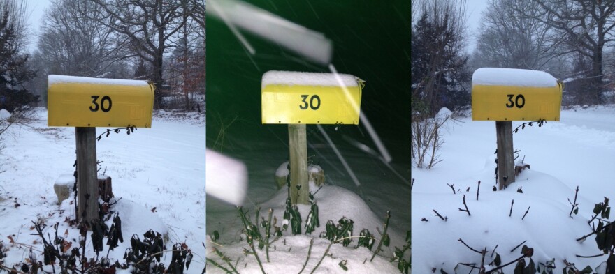
January 22, 2014 - 10am With snow still falling steadily, it seems a bit early to declare "before and after," so we'll call it "then and now" ... at least for the time being.

See more of what the storm has delivered so far, in our slideshow. And send us your blizzards shots!
January 22, 2014 - 8am A Blizzard Warning remains in effect for Cape Cod and the Islands through one o’clock this afternoon. Three-to-six inches of snow fell overnight, and we’re expecting more steady snow this morning. A big concern is the wind, arctic air and the wind chill. Temperatures today in the upper teens to lower 20's but it will feel a lot colder. Forecasters expect gusty winds at 40 to 50 mph through the day.
Many events and activities have been canceled. Most schools are closed, including Cape Cod Community College and Bristol Community College. Hospitals are open but many physician and outpatient facilities are closed. Travel is dicey. It was definitely white-knuckle driving last night for many of us, and this morning a number of roads are in poor condition. The Steamship Authority, Cape Air, and bus lines anticipate delays and/or cancellations today. If you need to be someplace this morning, call ahead and give yourself a lot of extra time to get there.

January 21, 2014 - 7:1opm Keeping it simple. Here's your "Short Form" weather forecast:
Blizzard Warning - Start time 7pm this evening and extends to 1pm Wednesday.
Snow Accumulation - Today 1 - 3 inches, overnight 6 - 8 inches, more tomorrow. Total - 12 - 15 inches.
Wind - North 20 - 30 mph gusting to 50 mph, gusts as high as 60mph possible on Nantucket and Outer Cape. Winds diminish Wednesday afternoon.
Temps - Upper teens overnight, teens and low twenties on Wednesday.
January 21, 2014 - 6:44pm The National Weather Service has issued some early snowfall totals for our region.
- Harwich 2.5 inches of snow as of 6:04pm
- West Yarmouth 1 inch of snow as of 5:31pm
- Wellfleet 1 inch of snow as of 5:30pm
- New Bedford 2.5 inches of snow as of 5:02pm
- Vineyard Haven 2 inches of snow as of 6pm
January 21, 2014 - 5:54pm School closings for tomorrow are piling up faster than the snow. The Cape Cod Times has a list of school closings here. They also have a very good list of cancelations for other events. The way the forecast looks now, it's hard to imagine anything scheduled for tomorrow morning not canceled.
January 21, 2014 - 5:10pm It's snowing in earnest now. Meteorologist Phil Burt of CapeCodWeather.net tells WCAI's Steve Junker that this storm will "take its sweet time getting out of here tomorrow." He also explains why we aren't facing the kind of coastal erosion that we did from the last blizzard.
January 21, 2014 - 3:05pm You may have heard that The Weather Channel has dubbed this storm "Janus," or that it's caused by a phenomenon known as "bombogenesis." Name or no name, a classic nor-easter is hitting the northeast and the National Weather Service says the Cape and Islands should see a foot of snow - give or take a few inches. Cancellations are already rolling in, so check our Guide to Winter Storm Coverage if you're headed out. Better yet, settle in with a hot cuppa and watch the white pile up.


