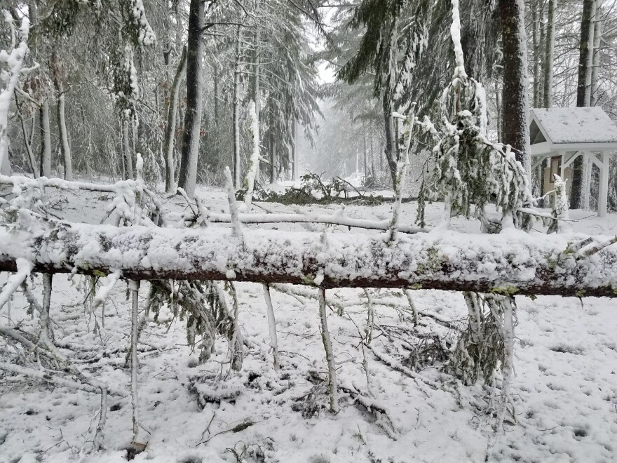
March is definitely coming in like a lion, as the region receives its third powerful storm of the month and its first blizzard of 2018. Here are updates.

11am - Utility crews are scrambling to restore power to those who have gone through one night without electricity. At this hour 105,ooo homses and businesses across Cape Cod are still without power. Almost 4,000 on Martha's Vineyard are without power. More than 13,000 on the South Coast are without power. Governor Baker is holding a round table conference in Barnstable this afternoon at 12:30 to address the storm aftermath. He'll be joined by Senator Vinny deMacedo, Senator Julian Cyr, Representative Sarah Peake, Representative Will Crocker, Representative Randy Hunt, Representative Tim Whelan, utility representatives and emergency responders from Barnstable County to discuss the impact of the most recent nor’easter at the Barnstable County Multi-Agency Coordination Center.
9:00pm - The snow has mostly tapered off for the Cape and Islands but many schools are closed for Wednesday. The National Weather Service reports these snowfall totals for our area: 9.2 inches in East Falmouth, 9.0 in Hyannis, and 8.0 in Harwich. The snow is heavy and wet and power outages are still a major issue. Here are the outages: 55% Falmouth, 57% Bourne, 90% Sandwich, 72% Mashpee, 61% Barnstable, 46% Yarmouth, 92% Dennis, 77% Brewster, 98% Harwich, 90% Chatham, 38% Eastham, 3% Truro, 9% Wellfleet, 28% Provincetown. On Martha's Vineyard: 53% Chilmark, 9% West Tisbury, 27% Edgartown, 5% Oak Bluffs. Nantucket has around 600 customers without power.
2:30pm - Power outages once again a major story. Power outages are widespread and numerous across the region. On Cape Cod and Martha's Vinyard, about 123,000 are without power at this hour. 22,000 are without power on the South Coast, and just a scattered handful without power on Nantucket.

11:30am - Here’s what Eversource MA is reporting for outages in our area as of 11:30AM. These are % of customers without power: 100% in Provincetown, 85% in Sandwich, 66% in Yarmouth, 54% in Falmouth, 53% in Rochester, 37% in Eastham, 35% in Barnstable and 35% in Wareham.
9:45am - As the wind and heavy snow continues, power outages have also started to accumulate, particularly on the upper Cape and in Plymouth. Eversource is reporting several thousand without electricity in Plymouth and Barnstable. National Grid shows close to 70 customers without power on Nantucket.
6:15am, March 13th - The National Weather Service is reporting snowy, windy conditions around the region. Overnight snow totals were a bit less than forecast - 1 to 2 inches. Wind gusts were in the upper forties in most places, with a gust to 51 mph reported in Woods Hole and 63 mph early this morning on Nantucket. So far, power outages are minimal; Eversource is reporting several dozen customers without power in Sandwich, Barnstable, Brewster, and Chatham.

Conditions are expected to worsen this morning, with whiteout conditions and snowfall rates up to three inches per hour, at times. Snow will fall steadily throughout the day, and could total up to more than 18 inches on the upper Cape and South Coast. Snowfall totals will be slightly less on the outer Cape and Martha's Vineyard, and Nantucket may get less than eight inches.
A coastal flood warning will go into effect 8am-noon, around this morning's high tide. A storm surge of 3-3.5 feet could bring minor coastal flooding to vulnerable areas, including Sandwich, Chatham, and Nantucket Harbor. With seas forecast at 20-25 feet, coastal erosion is a significant concern for east-facing shorelines, particularly those already compromised by the previous storms.
-----
11:05pm, March 12th: The region is under a blizzard warning, with the National Weather Service calling for wind gusts up to 65 miles per hour and 12-18 inches of snow by Tuesday evening. Power outages are, again, a concern, especially along the coast, where snow is expected to be wet and heavy. Coastal flooding and erosion are also expected from Hull to Nantucket - although to a much lesser extent than ten days ago.
The heaviest snowfall is expected in the morning hours, causing hazardous travel conditions. Many schools and events have already canceled. Check WHDHTV for a statewide list of closures and delays. For information on ferry service to and from the islands, check with the provider - Steamship Authority and Hy-line Cruises.
We'll be updating this post throughout the storm, so check back for the latest on local impacts and forecasts.
The month started with a powerful storm that packed 90+ mile per hour winds and hit at high tide, causing widespread, severe coastal flooding. And, of course, power outages. Some were just getting electricity back, when another storm hit and knocked it out again. Now, a third storm is expected to bring heavy snow and high winds.
*** Live storm coverage on The Point, 9-10am.
*** Share your experience on-air by calling 866.999.4626 or on Facebook.


